top of page


Seen over
300,000
times last month on Google
Sightseeing
Explore the best sightseeing spots in Northern Cyprus, where rich history meets natural beauty and Mediterranean charm. From ancient ruins and medieval castles to golden beaches, mountain trails, and coastal towns, this region is filled with unforgettable places to visit. Discover top attractions in Northern Cyprus, including cultural landmarks, scenic viewpoints, and hidden villages that showcase the island’s unique heritage. Whether you’re seeking adventure, relaxation, or simply want to soak in breathtaking views, Northern Cyprus offers endless things to do and hidden gems waiting to be explored.

Acendu Fountain

Alsancak

Archaeology Museum

Ayia Zoni Church

Baldoken Graveyard

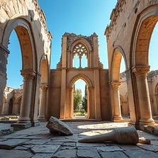
Bellapais Abbey

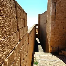
Buffavento Castle

Cafer Pasha Hammam

Cumbez Tree

Dükkanlar Önü Mosque

Enkomi Village

Galaktini Cave

Geçitköy Dam

Güzelyurt Museum

Incirli Cave

Karaoğlanoğlu Memorial

Karşıyaka

Kyrenia Castle & Harbour

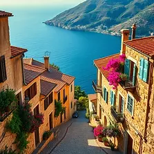
Lapta

Lefkoşa Venetian Walls

Mevlevi Tekki Museum

Namik Kemal Dungeon

Panagia Chrysopolitissa

Piri Mehmet Pasha Mosque

Rivettina Bastion

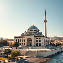
Selimiye Mosque

Sourp Magar Monastery

St Francis Church

St Mamas Monastery

Stargazing
The New Mosque

Turunçlu Mosque

Vouni Palace

Agha Cafer Pasha

Antiphonitis Monastery

Arsenal Bastion

Ayias Trias Basilica

Bandabulya

Besparmak Mountains

Büyük Hamam

Catalköy

Cyprus Car Museum

Efendi Fountain

Esentepe
Ganchvor Monastery

Gidilecek Son Nokta

Haydar Pasha Mosque

Iplik Bazaar Mosque
Karmi Village

Kumarcilar Han

Kyrenia Gate

Lefke

Lusignan House

Minia Cyprus Museum
Notre Dame de Tyre

Panayia Pergamininiotissa

Porta Del Mare Gate

Round Tower

Shaykh Nazim's Dergah

St Andrews Church

St George of the Greeks

St Mary Church

Tatlisu

The Noble Peasant

Varosha Ghost Town

Vounous Cemetery

Agios Sozomenos

Apostolos Andreas

Art Galleries

Bafra

Bedesten

Boğaz (Karpaz)

Büyük Han

Cengiz Topel Monument
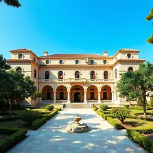
Dervis Pasha Mansion

Efendi Water Cistern

Famagusta

Gemikonağı

Greco-Roman Rock Tombs

Historical Tank

Iskele

Karpaz Gate Marina

Kyrenia

Lala Mustafa Pasha

Lefke Aqueduct

Malatya Waterfall

Monumental Olive Trees

Othello's Tower

Peace & Freedom Museum

Railways

Salamis Ruins

Sinan Pasha Mosque

St Anne Church

St George of the Latins

St Nikolas Church

The Blue House

The Royal Tombs

Venetian Column

Wild Donkeys

Alagadi Turtle Beach

Arapahmet Mosque

Ayia Philon Church

Bahçeli

Bellapais

Breweries

Büyükkonuk Village

Chain Tower

Dr. Fazıl Küçük Museum

Elausa Monastery

Flora & Fauna

George VI Monument

Güzelyurt

Hz. Ömer Tomb

Kantara Castle

Karpaz National Park

Kyrenia Amphitheatre

Lapidary Museum

Lefkoşa
Martinengo Bastion

Museum of Modern Arts

Ozanköy

Petra tou Limnidi
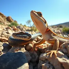
Reptiles & Snakes

Sculpture

Soli Ruins

St Barnabas Monastery

St Hilarion Castle

St Simeon Church

The Cave of St Fanourios

The Twin Churches

Venetian Palace

Zeytinlik
bottom of page